Coastal strip
Urban development follows a long Red Sea edge.
 Account
Sudan · Africa
A Port Sudan map is a Red Sea composition before it is a dense street study. The long coastline, harbor basins, causeways, and the narrow urban strip between water and dry land create the main geometry. Showing the sea generously makes the port structure easier to understand and gives the map its strongest visual contrast.
Free to style and share · no account required
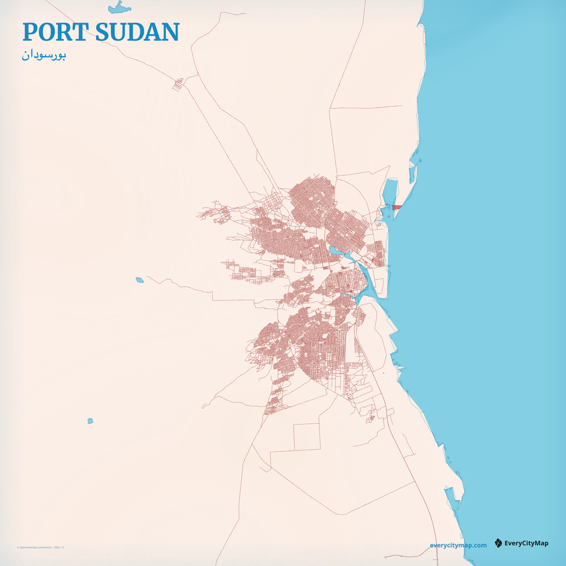
Three decisions that make this city recognizable before a label is added.
Urban development follows a long Red Sea edge.
North-south routes carry more structure than local blocks.
Basins and causeways explain the working port geometry.
Start with geography, then decide how much street detail the image can hold.
The street network is concentrated along the coast rather than spreading evenly in every direction. Major north-south routes organize the urban area, while smaller blocks gather around the port and established neighborhoods. A restrained road hierarchy reveals this linear pattern better than a uniformly dark network.
Harbor water is not background space: it cuts into the city and separates working port areas, islands, and shore connections. Give coast and enclosed water different enough weight that the edge remains readable. The result can feel almost diagrammatic without adding labels or landmark icons.
Atlas gives the harbor and coast the clearest structure. Watercolor Atlas can turn the Red Sea into the dominant pigment field, while Ink produces a simple land-and-network study. Keep the sea visible in every version; replacing it with a tight road crop removes the spatial constraint that makes Port Sudan distinctive.
Port Sudan is a strong subject for a geography study, a port-city comparison, or an editorial travel graphic. A tall crop follows the coastal settlement; a wide crop gives the harbor more context. Before export, check whether the enclosed basins and narrow shore connections survive at the intended display size.